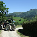
This blog describes my 24-day traverse of the Pyrenees from Atlantic to Mediterranean, July 2011.
The Pyrenean Haute Route is around 800km with 42,000 metres of ascent.

Map of the route | Schedule

Stages:
1 | 2 | 3 | 4 | 5 | 6 | 7 | 8 | 9 | 10 | 11 | 12 | 13 | 14 | 15 | 16 | 17 | 18 | 19 | 20 | 21 | 22 | 23 | 24

Wednesday, July 6, 2011

Day 6 - Source de Marmitou to Col du Somport

6th July 2011

HRP - Day 6

Day 6, and my aim for the day was to see if I could reach Candanchu and rendezvous with Trevor Richens. The day started with a descent into freezing fog and pretty murky conditions all the way down to Lescun.

Lescun was a much greyer, duller place than I was expecting, but luckily it had an open supermarket and hotel next door where I could sit with a coffee for half hour, whilst trying to dry out my shoes and tape up my disintegrating toes.

I set off with slightly fresher feet, but a much heavier pack laden down with several days food, since I didn't know when I'd see another shop, or whether I'd definitely meet up with Trevor.

The trail lead up into a cloudy Labrenere valley, before climbing to the Col de Pau 1942m, where I suddenly burst out of the mist into bright sunshine. I had a chat with a Frenchman at the col before heading off towards Refuge d'Arlet on a fine trail with magnificent views. For the first time since starting, I was actually covering the ground at a reasonable pace so realised that reaching Candanchu that evening might be a possibility.

I texted Trevor who was just hiking out from Ordessa to Torla.

I now had a target to meet, but on the long zigzag descent towards Pla d'Espelunguere, there was nothing in the guidebook about turning right to reach the plateau, so I just kept on battering down the main forest road until I realised I was well below the turning off point. I probably should have turned around and gone back up, but the route sticking to the road now looked simpler and safer. The only problem was that I need to drop a further 300 metres down hairpins and then hike northwards before I could get onto the old road heading up to Col du Somport.

I now had a 600m+ ascent on tarmac in dwindling light, heading up into the mist. All I could do was to grind out the fastest walking pace I could manage, texted Trevor my ETA at the summit, and then fixated on my climbing rate on my Suunto.

With a mile or so to go, Nicki and Trevor suddenly appeared out of the mist in their hire car. Trevor jumped out and raced after me in his sandals brandishing a can of coke and bar of chocolate. This raised my spirits enormously and at around 9.45pm we reached the old border crossing and checked straight into an Auberge on the Spanish side. I then took my first shower since starting the trek, and sat down to a much-needed meal with Nicki and Trevor.


View HRP - Day 6 in a larger map

Tuesday, July 5, 2011

Day 5 - Port de Larrau to Source de Marmitou

5th July 2011

HRP - Day 5

Today started with a 5 minute descent to reach the Port de Larrau road crossing, followed by a long sweeping ridge running eastwards along the French/Spanish border. I saw nobody for the first few hours until I was above the Cabane d'Ardanne when I whole bunch of French people suddenly appeared.

I intercepted a group of 4 Frenchmen at the Col Uthu and stopped for a chat. One of the guys suddenly declared "écossais" to me, which left me a bit confused. But I was even more surprised when they said "you are the Scottish man doing the HRP in 23 days"! The mystery was solved when they explained they had met Claude (the 18-day HRP Frenchman) at Chalet Pedro the day before, and he'd told them to watch out for me.

Anyhow, after a bit of chat I thought I'd better press on, but seeing as my feet were blummin agony at every footstep, it was hard to generate much pace. Hence every time I stopped for a moment the 4 Frenchmen would catch me up again. This continued all the way to the Refuge de Belagua which turned out to be massively disappointing, and potentially quite serious, since there was no clean water source and the next section enters dry karst country. Luckily I'd grabbed some water from a good stream just before Belagua, but it was nowhere near enough water for my lunchstop and the 6-hour afternoon stage.

I couldn't be bothered to hike up above the road to look for a clean source, and was sure something would turn up, although the massive flocks of vultures I passed to enter the karst landscape felt slightly ominous.

As things turned out, there was not a drop of water to be found, and the dehydration was really getting to me. A couple of times I needed to stop and lie down, right on the verge of falling asleep, before galvanising myself to keep going. The landscape got wilder and wilder, and reminded me of the Californian Sierra Nevada. Eventually I reached the Col d'Anaye and the ordeal was almost over. I just needed to stagger down a steep rocky descent to reach the Source de Marmitou, and within moments of taking a good drink I felt fine again.

There were still a couple of hours daylight left, but the location for wild camping was absolutely stunning, so there seemed little point in continuing. And funnily enough, within half an hour, the 4 Frenchman from earlier in the day also arrived, so it was nice to see them again and to compare notes about the trek through the karst wilderness.


View HRP - Day 5 in a larger map

Monday, July 4, 2011

Day 4 - Refugio de Azpegi to Port de Larrau

4th July 2011

HRP - Day 4

It was cold and grey as I left Azpegi Refugio. The first few kilometres were all on small tarmac roads cutting through grazing pastures for wild horses and sheep. It was quite a soft gentle landscape with waves of hazy hills disappearing northwards into France.

After passing a small farm there was a steep rough descent to a footbridge, then zigzags climbing through sopping wet grass to the Col d'Errozate. It was all pretty quiet and deserted but for a few horses.

After crossing the road at Egurgui there was a very steep slog up a pathless hillside towards the Crete d'Urkulu before reaching a dirt track after the Col d'Oraaté which soon joins the GR10. Once on the GR10 the route find was pretty obvious and took a steep descent through woodland into a pleasant valley where I stopped at Chalet Pedro for some lunch - a much need bowl of pasta - my first proper meal since starting the route.

A group of 4 hikers on the next table left just before me, and I eventually met them again in a few hours time at the Col Bagargui. They were from Denmark and were hiking a few stages of the GR10. The shop at Col Bagargui was expensive and had very little selection which was slightly depressing, but not quite as depressing as the pain in my feet, which was now moderately excruciating. The Danes seemed rather surprised that I was continuing at around 4pm, but there were of course 5.5 hours of daylight left, so I had no choice.

The next section of trail seemed unnecessarily complicated in order to reach the Crete de Millagate and Col de Tharta, but from here the objective couldn't simpler since you have the mighty Pic d'Orhy staring you in the face.

I was slightly daunted to be starting this 600m climb up such an exciting looking mountain so late in the day, but I tried to rationalise what was the worst that could happen. And the sense of tension made me climb that much harder and faster.

The views were quite mesmerising, with wave up on wave of hazy hills vanishing to the horizon.

It was pretty cold and windy on the summit, and then very steep and rocky on the descent at first, so I couldn't really relax. Once a bit lower, the angle eased and at last I was just above the road at Port de Larrau where I bivvied for the night.


View HRP - Day 4 in a larger map

Sunday, July 3, 2011

Day 3 - Col Basabar to Refugio de Azpegi

3rd July 2011

HRP - Day 3

Feeling fairly weary on my 3rd day, I trundled over the Col de Berdaritz and down to Aldudes with a slight sense of dread that nothing would be open on a Sunday morning. I was also slightly confused that I'd just crossed the border southwards from Spain back into France, which seemed a bit counterintuitive since I normally think of France as being north of Spain.

Anyhow, to my surprise and relief the petrol station on the far side of Aldudes was not only open, but had quite a decent supermarket and pharmacy, so I stocked up as best I could. There was not however a tap or poubelle, so I had to leave my rubbish on a table, and walk back into the village to find a source.

So, after much faffing and to-ing and fro-ing, I final located the not-very-obvious steep steps that launch you back onto the trail, but soon had to stop again on a grassy shoulder below Otsamunho to sort my feet out. My 4 smallest toes were now already seriously blistered and painful, so I drained the fluid, washed them in 70% alcohol and taped them up again.

The hiking was fairly easy and pleasant on an open ridge with expansive views. Before long I hit a road and the next few kilometres were all on tarmac to the Col de Lindux which is where you drop back down into Spain to the Col de Roncevaux which has an ugly modern chapel and car park. I re-grouped and re-taped my toes which were falling apart by this stage, and then began a steady climb up an old abandoned road into misty murky weather.

Having seen virtually nobody on the trail so far, I was suddenly confronted with dozens of hikers emerging from the mist. The reason being that I'd just merged with the pilgrim's route Camino de Santiago. In the next hour or so I saw every type of hiker: Solo, large groups, massively over-equipped and massively under-equipped, wearing boots, wearing sandals, the fit, and the not so fit.

The weather was turning increasingly grotty, and started spattering with rain as I turned away from the mass pilgrimage towards Col d'Arnosteguy. I saw a perfect camping spot beside a border stone, but I really needed to get further along the trail so just kept going. The next couple of km was lumpy ground with cattle, so no decent camping spot, however I'd seen signs for Azpegi Refugio, so was tempted to check this out. It was slightly off the HRP down a valley in the direction of Orbaitzeta, and turned out to be well worth the detour. It was a fine unmanned bothy in perfect condition and gave excellent shelter for the night.


View HRP - Day 3 in a larger map

Saturday, July 2, 2011

Day 2 - Col d'Ibardin to Col Basabar

2nd July 2011

HRP - Day 2

Day 2 started with a saunter down to Col d'Ibardin for a coffee and to grab some provisions. I then hiked along dirt tracks towards La Rhune. After Col de Lizuniaga I stopped to check my feet and realised that my toes were already blistered, just as predicted and despite taping them. I drained the blistered, re-taped them and carried on, still in a bit of a daze and not moving quickly. Suddenly I realised I was being caught rapidly by a fast moving hiker with trekking poles. I hung back to let him catch me more quickly and then joined him for a while, moving at a blistering pace in more ways than one. We passing through familiar territory since we were now on the GR11.

The hiker was a Frenchman called Claude who had started from Hendaye that morning, and was planning to complete the HRP in 18 days. I couldn't really see this was possible, but I admired his determination.

We stopped for a quick bite to eat at last year's GR11 first bivvy spot. I set off slightly ahead to catch another lone hiker who had just passed. I soon caught him and we started chatting. He was Robin from the Netherlands, and was also hiking the HRP. After the road crossing at Col d'Esquisaroy all 3 of us were climbing a steep dirt trail, but Claude was really hammering the pace so I closed him down at the crest of the ridge in order to confirm the route choice. He was planning to drop to Elizondo on the GR11 (which I did last year) whereas my book gave the route via Arizkun. I decided to stick with original plan, however Claude was talking about pressing on all the way to Aldudes that evening. I wasn't sure if that was possible, but I half wondered if I would see him there if I got down the hill quickly to Arizkun.

I looked back to see what Robin was up to, but we seemed to have dropped him, so I cut eastwards of the ridge and followed what I thought was the trail marked on my map. Unfortunately my map was not of good quality, and I had turned off the ridge too soon straight into a pretty impenetrable forest. I ended up thrashing around in the forest hurting my blistered feet and wasting time, and getting thoroughly confused. Eventually I decided to cut my losses by climbing back up towards the ridge and hacking across through the burnt gorse bushes to get to a good dirt road that looked like it might get me off the hill. My map only showed a small fraction of the tracks, so it was navigation by intuition and pot luck that got me down to Arizkun, but I'd wasted so much time, I'd more or less written off the idea of getting to Aldudes that evening.

I thought it would be more useful to have a proper rest, and to buy some more food and to eat and drink a good bit in Arizkun before setting off again. After one false start, I found the correct trail out of Arizkun, and then had to follow the guidebook descriptions to the letter to figure out the route through the maze of tracks up towards Burga. The descent off Burga was much rougher and more awkward than I was expecting, so when I finally hit Col Basabar around 9pm, it seemed sensible to pitch the tent, and to continue in the morning to Aldudes.


View HRP - Day 2 in a larger map

Friday, July 1, 2011

Day 1 - Hendaye to Col d'Ibardin (almost)

1st July 2011

HRP - Day 1

Day 1 began with a 5am alarm call in Glasgow to catch a flight to London Stansted, then another flight to Biarritz, where I jumped on a bus to St Jean de Luz. I then had a 40 minute wait, which was just long enough to buy some food and sort my rucksack before catching the bus to Hendaye.

Hendaye was awash with surfers and beach goers. I spent a few minutes taping up my toes, and getting some photos on the beach before turning left and aiming for the Atlantic. It was around 6pm by the time I got going, so I knew I wouldn't get that far this evening. I was a bit spaced out from the travel and not organised enough to have the compass in my hand, so I repeatedly lost the GR10 markings and ended up just making up my own route to reach the hills above Biriatou.

After 3 hours or so I reached a flat area on a sort of col with grazing wild horses and pitched the tent, and was pleased to have a lie down.


View HRP - Day 1 in a larger map

Wednesday, June 29, 2011

Nearly there

With just over 48 hours before kick off, my biggest concerns are:
  • Remembering not to forget anything 
  • Remembering not to take too much
  • Fear that my feet will become trashed with blisters after Day 1
Every time I've done a long hike with a tent my feet have been agony after a couple of days. I've done a bit of reading, and perhaps the best way forwards is to tape my toes with duct tape right from the start.

http://www.fixingyourfeet.com/Taping-for-Blisters.html

I'll practice tonight to see if I can wrap my toes with duct tape, without causing lumpy bits that dig in.

It would be nice to avoid the mind-blowing, excrutiating foot pain I suffered when hiking the GR11 and GR20.

Normally I get blisters on my smallest 2 toes on each foot by the end of Day 2, which then become very painful for the rest of the trip.

I'm not sure if the type of sock makes much difference?

Still to do:
  • Get currency
  • Charge camera batteries and check out extra xD card
  • Investigate spare mobile phone battery
  • Add new headtorch batteries
  • Test duct tape theory, and possibly get more duct tape.

Monday, June 27, 2011

Final Preparations

Not long now before leaving for the HRP. 4 days and counting...

I'm more or less ready and organised, pending the usual last minute decisions.

I'm taking 2 extra things compared with the GR11 - the Camp Corsa ice axe and Kahtoola Microspikes - hence I'm trying to lose weight in other areas. I've chopped off the cover of the Cicerone Press guidebook, which loses 100g, and I've bought some titanium tent pegs, which saves another 100g. Also I'm not taking a stove or pan, which saves space and weight.

All my maps are colour photo-copied double-sided onto waterproof A4 paper. I will dispose of these en route, and likewise I will cut down the guide book as I go with a penknife, until there's nothing left of it.

I will probably leave the ice axe behind, or give it to someone travelling in the opposite direction, rather than carrying it all the way.

My biggest concern is not really knowing what the weather will be like, and whether I'll be much more exposed to the elements on the Haute Route compared with the GR11. I'm expecting the route finding and terrain to be slighty more challenging. I might buy another compass since mine was behaving very oddly at the Arrochar Alps race on Saturday.

Other things to do before leaving on Friday:
  • Get more euros
  • Re-proof and seal tent and groundsheet
  • Fine tune first aid stuff and blister plasters
  • Resealable A4 bags and freezer bags
  • Change in euros for Airport bus to Hendaye (via St Jean de Luz)
  • New socks?
  • Put new batteries in headtorch
  • Take spare duct tape
  • Camera - charge 2 batteries. Lens cloth. Take extra xD card?

Tuesday, May 31, 2011

Schedule

My schedule for the Haute Route is fairly ambitious.

I plan to start on Friday 1st July at about 5.30pm, as soon as I step off the bus at Hendaye.

My return flight from Girona is booked for Monday 25th July, which gives me 23 full days (plus a few hours on the evening of 1st July) to complete the coast to coast.

I'm not sure if this is feasible, but I managed the GR11 in 23 days last year, and I'm hoping the HRP might take about the same time.

Provisional schedule:
http://chris-upson.com/HRP/HRP_Stages_v2.xls

Friday, May 27, 2011

Thursday, May 26, 2011

Re-supply points

Courtesy of this trip report, the following re-supply points have been identified:

o Hendaye: before starting; several adequate grocery stores are available.
o Arizkun: two small stores with limited, but sufficient selection.
o Les Aldudes: a surprisingly useful quick mart in the gas station.
o Col Bagargui (Irati): very small shop at the ski resort.
o Lescun: a well-stocked medium sized market.
o Candanchu: tiny Supermercado El Bozo (easily missed!)
o Gavarnie: small, but moderately well-stocked grocery
o Salardu: barely adequate small market.
o l’Hospitalet-pres-l’Andorre: barely adequate small market and deli.
o Bolquere: excellent market and great deli.
o Le Perthus: huge stores with everything you could ever want.

Postscript: In retrospect, I didn't use Hendaye, but shopped at St Jean de Luz before starting.
I found some provisions at a bar in Arizkun.
Aldudes had a well-stocked petrol station that was open on Sunday morning.
Col Bagargui had a poorly stocked shop, but was at least open.
Lescun had a good small supermarket.
I went via Col du Somport rather than Candanchu.
Gavarnie had good small supermarket.
Salardu, supermarket was small but OK. I was lucky to catch it open, since it shuts at 1.15pm for the afternoon.
Hospitalet was disappointing. There was nothing open except a hotel.
Bolquere had a good small supermarket that was shut when I arrived, but opened at 4pm.
Arles-sur-Tech had good Spar supermarket that was also shut, but opened at 3pm.
Le Perthus was an absolute grim dump of a town. I would strongly recommend passing straight through without stopping if at all possible. I did eventually find a supermarket that seemed mainly to sell large volumes of cheap alcohol. That tells you all you need to know about the place.

Wednesday, May 25, 2011