
 |
| HRP - Day 2 |
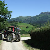
Day 2 started with a saunter down to Col d'Ibardin for a coffee and to grab some provisions. I then hiked along dirt tracks towards La Rhune. After Col de Lizuniaga I stopped to check my feet and realised that my toes were already blistered, just as predicted and despite taping them. I drained the blistered, re-taped them and carried on, still in a bit of a daze and not moving quickly. Suddenly I realised I was being caught rapidly by a fast moving hiker with trekking poles. I hung back to let him catch me more quickly and then joined him for a while, moving at a blistering pace in more ways than one. We passing through familiar territory since we were now on the GR11.
The hiker was a Frenchman called Claude who had started from Hendaye that morning, and was planning to complete the HRP in 18 days. I couldn't really see this was possible, but I admired his determination.
We stopped for a quick bite to eat at last year's GR11 first bivvy spot. I set off slightly ahead to catch another lone hiker who had just passed. I soon caught him and we started chatting. He was Robin from the Netherlands, and was also hiking the HRP. After the road crossing at Col d'Esquisaroy all 3 of us were climbing a steep dirt trail, but Claude was really hammering the pace so I closed him down at the crest of the ridge in order to confirm the route choice. He was planning to drop to Elizondo on the GR11 (which I did last year) whereas my book gave the route via Arizkun. I decided to stick with original plan, however Claude was talking about pressing on all the way to Aldudes that evening. I wasn't sure if that was possible, but I half wondered if I would see him there if I got down the hill quickly to Arizkun.
I looked back to see what Robin was up to, but we seemed to have dropped him, so I cut eastwards of the ridge and followed what I thought was the trail marked on my map. Unfortunately my map was not of good quality, and I had turned off the ridge too soon straight into a pretty impenetrable forest. I ended up thrashing around in the forest hurting my blistered feet and wasting time, and getting thoroughly confused. Eventually I decided to cut my losses by climbing back up towards the ridge and hacking across through the burnt gorse bushes to get to a good dirt road that looked like it might get me off the hill. My map only showed a small fraction of the tracks, so it was navigation by intuition and pot luck that got me down to Arizkun, but I'd wasted so much time, I'd more or less written off the idea of getting to Aldudes that evening.
I thought it would be more useful to have a proper rest, and to buy some more food and to eat and drink a good bit in Arizkun before setting off again. After one false start, I found the correct trail out of Arizkun, and then had to follow the guidebook descriptions to the letter to figure out the route through the maze of tracks up towards Burga. The descent off Burga was much rougher and more awkward than I was expecting, so when I finally hit Col Basabar around 9pm, it seemed sensible to pitch the tent, and to continue in the morning to Aldudes.
View HRP - Day 2 in a larger map
1 comment:
Thank you for your detailed blog. It is very useful in the preparation of the HRP. It seems to me based on my map and the blogs I read that the frist sections (around Arizkun - Aldudes) are a bit confusing. Do you think it is worth trying to follow the HRP here, or would you recommend the GR11 for the first sections?
Kind regards,
Helen
Post a Comment